top of page
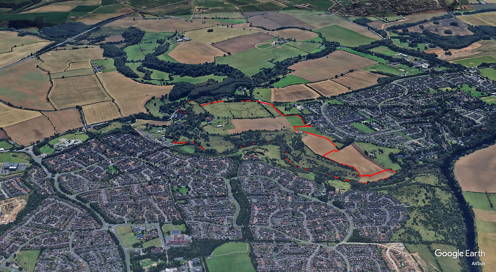
The Site
The site comprises 43.3 hectares of agricultural land to the north-east and east of Levendale. It is bounded by:
-
An agricultural field and the River Leven to the north
-
The River Leven Valley, Low Leven and the A1044 to the east
-
Woodlands and a small number of residential dwellings to the south
-
Built-up residential land in Yarm to the west
The whole site lies within an area that was allocated for residential development within the Stockton-on-Tees Borough Council Local Plan (ref. H1/2.Y4). An additional area of land to the north at the former Yarm Riding School is identified as a potential future housing development.
Video of the area
Click on the play button to view
bottom of page